Going Upstate? Bring a Map.
Upstater | May 28, 2013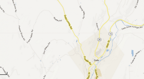
Ah, you’re saying, it seems like a no-brainer — why bother to give such advice? Well, because sometimes we at Upstater don’t make full use of our breadth of knowledge about traveling and living in Upstate New York, nor about scouting it. On a reconnaissance mission through Delaware County this weekend, we found ourselves stuck at a literal crossroads. No bars on the iPhone, no Gs beckoning from the top of this ridiculous gadget we’ve found ourselves dependent upon, we sat at the intersection trying to imaging which way to Andes, to Delhi, to all the other towns we’ve been so curious about and wanted to see.
Defeated by the gadget’s uselessness, we wound our way around the mountain and back to the house, where one of our friends bestowed upon us this nifty tool left over from the analog days. Hey, a map! Actually, an atlas! Neato, we said, recalling the pleasures of map-reading before our iPhone addition destroyed it, how we loved to trace our route along the road, to figure out alternate roads when the highway ahead suddenly alighted with the red of brake lights. This was before we were told that our phones could discern the most trafficky spots. When that app works, that is.
If you already live in the rural parts of Delaware County, then please hold your snickers. The rest of you: take note. If you’re heading to the western Catskills, don’t forget your map. We promise you, you’ll be using it.
Read On, Reader...
-

Jane Anderson | May 17, 2024 | Comment A Bucolic Red Hook Contemporary: $1.25M
-

Jane Anderson | May 16, 2024 | Comment A Cute-As-a-Button Cape Cod in Red Hook: $389K
-

Jane Anderson | May 15, 2024 | Comment A Log-Sided Cabin in Red Hook: $895K
-

Jane Anderson | May 14, 2024 | Comment A Red Ranch in Red Hook: $419K